There are five books in the Prydain series by Lloyd Alexander and they each have a map in the beginning showing the places the action takes place in that story. This is a fascinating way to do maps that I rarely see! Most book series have one map that carries through all of them. Each was drawn by Evaline Ness.

The first map, from The Book of Three, shows almost exclusively the western side of Prydain, since Taran heads west from Caer Dallben at the beginning and never really heads eastward again until he returns home at the end. This map shows few things that don’t feature in that first story and the topography is a bit confusing (part of the story is in mountains, but I’m not sure where there are and are not mountains). Still, the route is clear and the major landmarks all appear on the map, which is useful.
As a side note, these maps did not appear in the paperback editions of the series that I had as a kid and literally read to pieces. I didn’t know they existed or see them at all until I had already been reading the series for fifteen or twenty years and had very firm ideas about the landscape, layout, and routes in my head. The maps follow the directions in the book very well. The maps in my head do not. I am not good with directions.
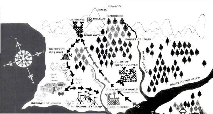
The map for The Black Cauldron heads in the same westerly direction, but this time is much zoomed in and shows more detail than we had in the larger view from the first book. Also, Spiral Castle is now in ruins on the map instead of appearing as a whole castle. This map makes me rather wonder how Taran missed Smoit’s realm if he had been that close in the first book, but I suppose he may have been carried through it entirely when he was captured. I find it kind of amusing that the magical cottage in the Marshes of Morva appears to be dramatically larger than Smoit’s castle or realm in general!
The third book, The Castle of Llyr, has a map of the Isle of Mona.

Just to further complicate the western part of the kingdom, we squish in even more castles that Taran inexplicably missed in the first two adventures for Taran Wanderer. We’ve also added more rivers and a whole area of the kingdom that apparently few people visit, yet is basically in the middle of the land. It’s very odd. The map my head made up reading it as a child made much more sense in this respect, putting the Commots on the far eastern side of the kingdom and out of the way of everything else… At least this map gives a better sense of mountains?

The last book in the series, The High King, pulls the map back out to roughly the scale of the first map. It keeps many of the landmarks of the previous maps, but also adds a few more. It’s a useful map and again shows all of the important places visited in the story. But somehow it leaves me feeling a little confused. I’m not sure if this is because my head-map is so different from it or if it’s actually confusing.
If nothing else, I find myself wondering what else is on the southern side of the Great Avren, since the only landmark ever shown there is Caer Dallben. Does Dallben own an island there or are there other things on that part of the land? It seems so odd that there’s nothing else there at all!
I find these maps interesting, even if unsatisfying. I suspect a big part of the problem for me is the mental disconnect between how I imagined the landscape for so many years being so different from the landscape depicted in the maps! Still, I love the way that the books each have a map tailored to the adventures contained in that specific book. It’s a great way to make the maps useful, to not reveal too much ahead of time, and to build the world as you go through the series.
